
NEWS
Tibet’s Magnitude 7 Quake Meets Winter at 4,864 Metres
A magnitude 7.0 quake killed 16 in Tibet’s Baqen County, and rescue teams now face thin air, a cut highway and minus 9 degree nights.

A magnitude 7.0 earthquake killed 16 people in Tibet’s Baqen County late Thursday and left 76 injured, officials in Nagqu said at a Friday briefing. The shock hit at 10:33 p.m. in a herding county that sits about 4,864 metres up, and rescue crews are now working through minus 9 degree nights, a cut highway, and aftershocks that kept families out of their houses.
Sixteen Dead, Then Minus 9 Degrees
The Nagqu municipal government information office gave the updated casualty figures at 1 p.m. on Friday, more than 14 hours after the mainshock. Deaths held at 16. The injured count had climbed as house-to-house checks reached more settlements, and 11 people had been listed in serious condition in earlier city tallies before that briefing.
By 10 a.m. Friday the city’s earthquake relief headquarters said 12,489 residents had been moved. Power failed across parts of the county after the shock, then came back in some places by Friday morning. Communications stayed down in pockets while crews worked on lines and base stations.
THE FRIDAY COUNT
- Dead: 16 people, unchanged through the 1 p.m. Nagqu briefing.
- Injured: 76 people, the figure announced at that briefing.
- Moved: 12,489 residents as of 10 a.m. Friday.
- Air and cold: about 4,864 metres at the epicentre, with nights down to minus 9 degrees Celsius.
Residents spent Thursday night in tents and cars rather than go back inside, and video from Nagqu showed students in sleeping bags in an open field. Aftershocks were the reason. State media said more than 400 had been logged by Friday morning, while the U.S. Geological Survey recorded at least seven between magnitude 4.3 and 5.2, the largest a 5.2.
Local weather offices said temperatures around the epicentre would fall as low as minus 9 degrees Celsius over the next three days, with intermittent snow due on Saturday in three townships near the rupture. That forecast, not the magnitude, is what the tents, stoves and winter coats are for.
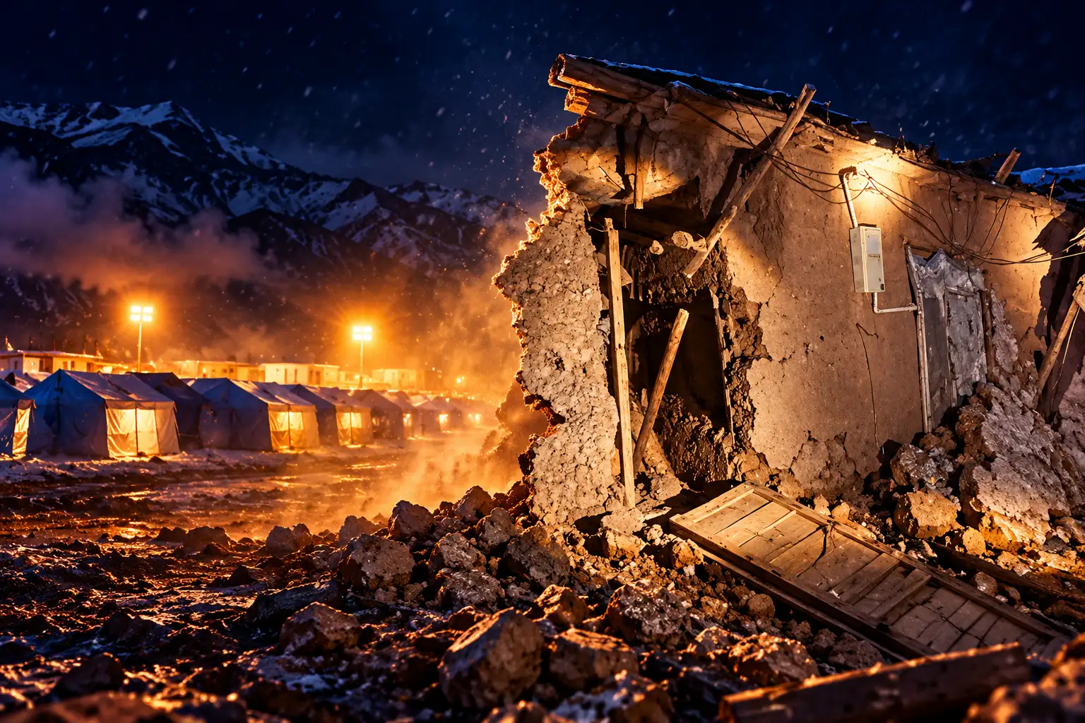
Mud Brick, Yaks and 20 Collapsed Sheds
Baqen County, also written Baqing in some mainland romanisations, sits on the east side of Nagqu on the northern Tibetan Plateau. A 2020 count put its permanent population at 56,200 across 9,811 square kilometres of high pasture. Animal husbandry is the main living. The county seat is in Laxi Town, a long way from many of the townships that took the strongest shaking.
City officials said at least 339 homes collapsed, along with 20 livestock sheds. Those sheds are not a footnote. Winter is arriving, and a herding household that loses a roof for animals loses the season’s buffer in the same night it loses a house. Ready-made housing, tents and cotton-padded coats were the first loads sent in, which matches a county that lives on livestock more than on shopfronts.
The USGS says the buildings most at risk in this part of the plateau are adobe block and unreinforced brick with mud mortar. CCTV clips from the night showed diners running out of restaurants and goods falling off supermarket shelves, the kind of indoor shaking that turns those walls into debris. Roasted barley flour, tsampa, was already being packed for the zone by Friday, a staple that belongs in herding country rather than in a generic disaster kit.
President Xi Jinping ordered an all-out search, medical treatment, and shelter for people who cannot go home. Premier Li Qiang called for urgent rescue work and noted that the stricken ground sits at about 4,800 metres and remains prone to aftershocks.
What the USGS Counted on the Plateau
The Survey’s reviewed magnitude 7.0 origin places the quake at 32.380 degrees north, 93.780 degrees east, 191 kilometres (119 miles) east-northeast of Nagqu, at 18.0 kilometres depth. Origin time is 14:33:40 UTC on 22 October, 10:33 p.m. in Tibet. ShakeMap intensity reaches VIII, severe. The China Earthquake Networks Center locates the same shock inside Baqen County and puts the average elevation within 5 kilometres of the epicentre at 4,864 metres, about 400 kilometres from Lhasa.
HOW THE TWO AGENCIES READ THE SHOCK
| Reading | U.S. Geological Survey | China Earthquake Networks Center |
|---|---|---|
| Magnitude | 7.0 mww, reviewed | 7.0 |
| Place | 191 km ENE of Nagqu | Baqen County, Nagqu |
| Coordinates | 32.380°N, 93.780°E | About 32.40°N, 93.79°E |
| Depth used here | 18.0 km, reviewed origin | Elevation 4,864 m within 5 km |
| Local time | 10:33 p.m., 22 Oct | 10:33 p.m. Beijing time |
USGS key points, updated at 16:52 UTC on 22 October, say about 111,000 people felt moderate to severe shaking, MMI V through VIII. Nagqu itself is listed at light shaking, MMI IV, with an estimated 505,000 people in that band. The Survey posted a yellow alert for shaking-related fatalities and an orange alert for economic losses, with damage likely and a regional or national response expected. Landslide hazard covers a significant area, though few people live on those slopes. Liquefaction is limited.
A yellow fatality alert and a 16-person official toll sit on the same fact: this rupture is large and the ground is thinly peopled. The orange economic alert is the other half of that fact. Mud-brick houses and livestock sheds fail in strong shaking even when the nearest city is a long drive away.
Rockfalls Closed a Stretch of Highway 317
Rockfalls shut a section of National Highway 317 to ordinary traffic, leaving the road to emergency, rescue and official vehicles while crews cleared debris. Railway operators halted trains through the zone. Those two cuts matter more here than they would on a lowland grid, because Baqen is a high, sparse county and the next hospital or depot is not around the corner.
China’s emergency management system raised the national earthquake response from Level IV to Level III on Friday, and the regional relief committee matched that with a Level III natural-disaster response. An emergency command post was set up on the front line. By Friday afternoon more than 5,000 people were deployed in search, medical, shelter and supply teams. Police and transport crews had inspected more than 1,700 kilometres of roads, 201 bridges and 324 culverts, cleared fallen rock at seven sites, and listed 11 hazards still to treat.
FROM 10:33 P.M. TO THE FRIDAY BRIEFING
- 22 October, 10:33 p.m.: Magnitude 7.0 mainshock in Baqen County; diners run into the street and goods fall from shop shelves.
- Thursday night: Families sleep in tents and cars; Highway 317 is restricted; trains through the region are stopped.
- Friday, early morning: Prefab houses, tents, beds, quilts and winter clothing reach the zone; the national response rises to Level III.
- Friday, 10 a.m.: City headquarters reports 12,489 people moved.
- Friday, 1 p.m.: Nagqu briefing holds deaths at 16 and raises the injured count to 76.
- Saturday (forecast): Intermittent snow in three townships near the epicentre, with nights near minus 9 degrees Celsius.
Round-the-clock watches were put on mountainsides, reservoirs, power stations, rivers, damaged buildings and telecom sites. Downed power and phone lines were coming back in stages on Friday, which is slower work at this height than the raw crew count suggests.
16 people were killed and 46 others injured after a 7.0-magnitude earthquake struck Baqen County of Nagqu City in China's Xizang at 10:33 p.m. Thursday (Beijing Time).
Quake relief supplies allocated by the authorities at various levels have been arriving at the quake-hit zone as… pic.twitter.com/2kyZEfyC8a— China Xinhua News (@XHNews) October 23, 2026
The Plateau Is Stretching East and West
The USGS says the 22 October shock was normal faulting inside the Tibetan Plateau, on a crustal fault that dips moderately to the northwest or the southeast. India collides with Eurasia and drives the Himalaya and the plateau up. The plateau is so high that it is also spreading east and west under its own weight, and this quake fits that east-west pull.
The Tibetan Plateau is the highest plateau in the world, and as a result, it currently extends to the east and west due to high gravitational potential energy. The normal faulting focal mechanism of the October 22 earthquake is consistent with this east-west oriented extension.
U.S. Geological Survey, tectonic summary, event us6000u43g
Quakes of this size are slip on a plane, not a point. The Survey says a magnitude 7.0 normal-faulting event typically ruptures a fault about 50 kilometres long by 20 kilometres wide. Since 1900, 29 earthquakes of magnitude 7.0 or larger have struck the plateau and its edges. The largest was the 15 August 1950 Assam-Tibet shock, magnitude 8.6, which killed more than 4,000 people. On 13 April 2010 a magnitude 6.9 event only 272 kilometres east-northeast of Thursday’s epicentre killed more than 2,500. The Survey’s own warning is plain: in this empty stretch of plateau, damage swings wildly with how close the rupture runs to the next cluster of houses.
Tents, Heaters and 3,800 Aid Kits
Loads coordinated by central, regional, city and county offices were in the zone by early Friday. The Red Cross Society of China sent a working team and 3,800 kits with family supplies, hygiene goods, heaters, tents, jackets, folding beds and quilts. The China Charity Federation put 3 million yuan (about $446,561) into the emergency.
RELIEF THAT HAD REACHED BAQEN BY FRIDAY
- Shelter: 1,000 prefabricated houses, more than 3,200 tents, and over 2,800 folding beds.
- Cold kit: quilts, stoves, clothes, plus Red Cross heaters and jackets in the 3,800 kits.
- Money: 3 million yuan from the China Charity Federation for rescue work.
- People: more than 5,000 on the front line by Friday afternoon, in search, medical, shelter and supply teams.
Tents went up at a primary school in Baqen County. That image is the winter problem in one frame: classrooms are not safe enough, the air is thin, and Saturday’s snow is still ahead. Heaters and cotton coats are as much a part of this operation as jacks and saws.
Tingri’s 126 Dead Are the Baseline
Northern Tibet has already been through this once in the past two winters. On 7 January 2025 a shock in Tingri County, in Shigatse, killed 126 people on the official count and brought down thousands of houses near the Everest approach. The USGS put that event at magnitude 7.1. A field study in the International Journal of Disaster Risk Science recorded the 3,612 houses that collapsed in Tingri, with 27,248 buildings damaged, in a zone where villages sat close to the fault and many walls were weak in shaking.
TINGRI 2025 AND BAQEN 2026
| Tingri, 7 Jan 2025 | Baqen, 22 Oct 2026 | |
|---|---|---|
| USGS magnitude | 7.1 | 7.0 |
| Official deaths | 126 | 16 |
| Houses collapsed | 3,612 | 339 |
| Setting | Tingri County, Shigatse, near Everest | Baqen County, Nagqu, about 4,864 m |
Thursday’s smaller official toll is not a gentler earthquake. It is a different map. USGS language on this event is that large plateau shocks vary with how close the rupture comes to people, and Baqen’s pastures hold far fewer villages than Tingri’s belt of settlements. The 339 fallen houses and 20 sheds still leave thousands sleeping in canvas at minus 9 degrees, with snow listed for Saturday and the main highway only partly open.
Tents are up at the primary school in Baqen. Crews are still walking damaged ground. The snow is due in the three townships nearest the epicentre on Saturday.

Ohtani Game 4 Logoman Card Sells for $3.24 Million

Cole Kmet’s Season Ends, and Chicago’s Tight End Plan Starts

NBA Seeks Soccer Money After EuroLeague Clubs Refused

Amazon’s First Bond Tests Leave the Broccoli Chair Empty

Tyrese Maxey Owns the Night Built for LeBron James

Warsh Rejects Rate Guidance and Still Moves Markets

Dana-Farber Exits an MGB Medicare Advantage Network Early

NASA Launches the Roman Space Telescope’s Cosmic Bet

OpenAI’s Cyber Letter Puts the Defense Bill on Governments

Russia Recycles Its Old Warning Over Storm Shadow Plants
-
 BUSINESS2 months ago
Warsh Rejects Rate Guidance and Still Moves Markets
-
 BUSINESS1 month ago
Dana-Farber Exits an MGB Medicare Advantage Network Early
-
 NEWS2 months ago
NASA Launches the Roman Space Telescope’s Cosmic Bet
-
 NEWS2 months ago
OpenAI’s Cyber Letter Puts the Defense Bill on Governments
-
 NEWS2 months ago
Russia Recycles Its Old Warning Over Storm Shadow Plants
-

 ENTERTAINMENT4 weeks ago
Primetime’s $2.7 Million Preview Tops Pitt’s Costlier Film
-

 BUSINESS2 months ago
Jet Drones Lock Down Kyiv and Strip Kherson of Heat
-

 NEWS2 months ago
Congo Starts Ervebo Vaccinations for a Different Ebola Virus